Back مقاطعة أوتاغامي (ولاية ويسكونسن) Arabic Outagamie County, Wisconsin BAR Аутагейми (окръг, Уисконсин) Bulgarian ঔটাগামি কাউন্টি, উইসকনসিন BPY Outagamie Gông (Wisconsin) CDO Аутагейми (гуо, Висконсин) CE Outagamie County CEB Outagamie County Czech Outagamie County, Wisconsin Welsh Outagamie County German
Outagamie County | |
|---|---|
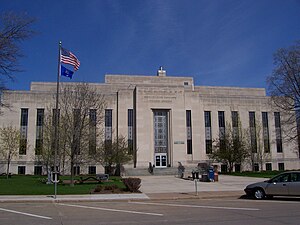
 Outagamie County Administration Complex | |
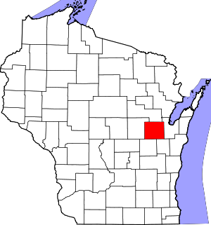
 Location within the U.S. state of Wisconsin | |
 Wisconsin's location within the U.S. | |
| Coordinates: 44°25′N 88°28′W / 44.41°N 88.46°W | |
| Country | |
| State | |
| Founded | 1852 |
| Seat | Appleton |
| Largest city | Appleton |
| Area | |
| • Total | 645 sq mi (1,670 km2) |
| • Land | 638 sq mi (1,650 km2) |
| • Water | 7.1 sq mi (18 km2) 1.1% |
| Population (2020) | |
| • Total | 190,705 |
| • Density | 300/sq mi (110/km2) |
| Time zone | UTC−6 (Central) |
| • Summer (DST) | UTC−5 (CDT) |
| Congressional district | 8th |
| Website | www |
Outagamie County (/ˌaʊtəˈɡeɪmi/ OW-tə-GAY-mee)[1] is a county in the Fox Cities region of the U.S. state of Wisconsin, located in the northeast of the state. As of the 2020 Census, the population was 190,705.[2] Its county seat is Appleton.[3]
Outagamie County is included in the Appleton, WI Metropolitan Statistical Area, which is also included in the Appleton-Neenah-Oshkosh, WI Combined Statistical Area. It was named for the historic Meskwaki (Fox) Indians.
- ^ MissPronouncer.com: A HALFWAY DECENT AUDIO PRONUNCIATION GUIDE FOR WISCONSIN
- ^ Cite error: The named reference
2020-census-55087was invoked but never defined (see the help page). - ^ "Find a County". National Association of Counties. Retrieved June 7, 2011.
© MMXXIII Rich X Search. We shall prevail. All rights reserved. Rich X Search